Introduction
Naxalism in India is currently seen as the most formidable challenge to governance. For the Central Government and the State Governments to stabilize the situation through the security forces, the critical need of the hour is a comprehensive information and communications management system.
This article describes a set of solutions for commanders of anti-Naxal forces to monitor patrol units in near-real time, when operating in the field. The solutions allow two-way data, voice and location-coordinates communications between a control centre and the various field patrol units, and act as force-multipliers for the patrol units in the field.
In this article we will be covering the newest technologies for setting up an Alert & Warning Systems (AWS) to provide clear, discernible warning under an emergency or disaster management program.
Existing practice
The areas currently designated as Naxal-active include the mineral-rich forest regions of Central and Eastern India. In such difficult and rugged terrain, the patrol units do not have real-time support or communication with the Control Centre. In case of immediate action to be taken, the patrol units do not have the technological support to reach out to other anti-Naxal units stationed nearby. There have even been instances of friendly fire between various anti-Naxal units, adding to the casualty number game.
Patrol units report their co-ordinates to their respective Control Centre on a periodic basis, either by VHF radio or cell-phone, when coverage is available in remote towns or villages. The co-ordinates are determined by means of a GPS unit, which is carried by the patrol unit. These co-ordinates are then manually recorded on a Google Maps or other cartographic images of the area.
The challenges posed by the terrain are patchy and in some cases, non-existent VHF radio and/or GPS coverage. The communication system has not been integrated to track the patrol units’ positions on a digital map directly. Manual transcription is still utilized in many areas. The Control Centre is left awaiting progress updates from their units till the units come under VHF or GPS coverage.
 |
| Figure 1: Proposed Communications solution for Anti-Naxal Forces |
Proposed Force-multipliers
Upgrade existing base and repeater stations
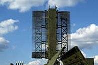
The existing VHF infrastructure has to be upgraded. The equipment at the existing base stations need to be replaced with the latest technology equipment. Repeater stations at appropriate distances between the base stations would help in transmitting the signals across the uneven terrain of the forests. The existing repeater stations also need to be upgraded.
In case of areas that do not fall under the coverage of existing base or repeater stations, the patrol unit can also carry portable repeater stations that they can drop at an appropriate location, where the signal is weak. These portable repeater stations can then be picked up by the unit once they finish their survey of the area, if required.
Digitization
With the current radio equipment, security for voice and data transmission is a major challenge. It is easy for anybody to tune into the radio frequency used by the team and tap into the information being shared. The radio equipment of the patrol unit needs to be upgraded to digital radio specifications. This will help to provide basic encryption of the voice and data transmissions. The digital radio unit will be carried in a specially designed haversack, to ensure that transmission and reception is optimized. The haversack could feature battery pouches to store batteries that power the radio, and these can be internally wired to the radio. In addition, switching from whip-antennas to tape-antennas, for the radio equipment, will allow consistent signal reception in an area regardless of whether the radioman of the patrol unit is upright or lying prone.
Command & Control Module
The command & control module provides a group of functions. The system has three modules that interact with each other, and can also be used independently – Cartography mapping and resource locator, communications matrix and call-taking & dispatch.
Cartography mapping and resource locator: GIS and AVL module allows resources (ground forces and sensors) and incidents to be mapped on to cartographic data, and tracked in real-time. It allows cartographic data from ground sources to be used, along with custom interpretations. In addition, a cartography map of the area can be used to show all the resources available in that area on the map in case additional resources need to be quickly deployed.
Communications matrix: Multi-protocol switch allows user to receive and patch voice calls between protocols such as V/U/HF, GSM, CDMA, PSTN, Tetra and VoIP. The touch-screen application is user-friendly, allowing drag and drop of caller icons over the protocols to be patched. This allows the operator to quickly patch different resources communication on different channels, saving valuable time and avoiding any possibility of miscommunication.
Call-taking and Dispatch: The easy-to-use Computer-Aided Dispatch (CAD) application with touch-screen interface and dual displays, allows the operator to receive calls, record details of an incident, and initiate necessary action.
Benefits/ Advantages
The proposed Anti-Naxal Forces solution will allow:
- Patrol units to communicate with the control centre through a secure channel
- Allows real-time information to be shared between patrol unit and base station
- Enables the ground forces to penetrate into areas that were so far inaccessible or out of decent communication range
The solution gives a broad perspective of what Mistral can provide for its customers in terms of integrated security solutions. Mistral has the capability to customize these solutions according to the needs and usage of the customer.