Tactical Drones
Unmanned ground vehicles, robots and tactical military drones are considered the future of warfare. Tactical Drones, in particular, are increasingly finding applications in sophisticated defense scenarios like military research, intelligence gathering at borders and on battlefields to carry out combat missions beyond enemy lines. One of the primary advantages of tactical military drones is their quick deployability in tough high-altitude terrains with extreme weather conditions. Tactical drones, especially, the rugged military drones are proving to be immensely effective for ISR (Intelligence, Surveillance and Reconnaissance) and are being widely used by Defense and special forces worldwide. Tactical Military drones allows the forces to quickly launch time-sensitive missions while reducing risk to the lives of pilots and soldiers.
Tactical Drones – Military Drones Designs
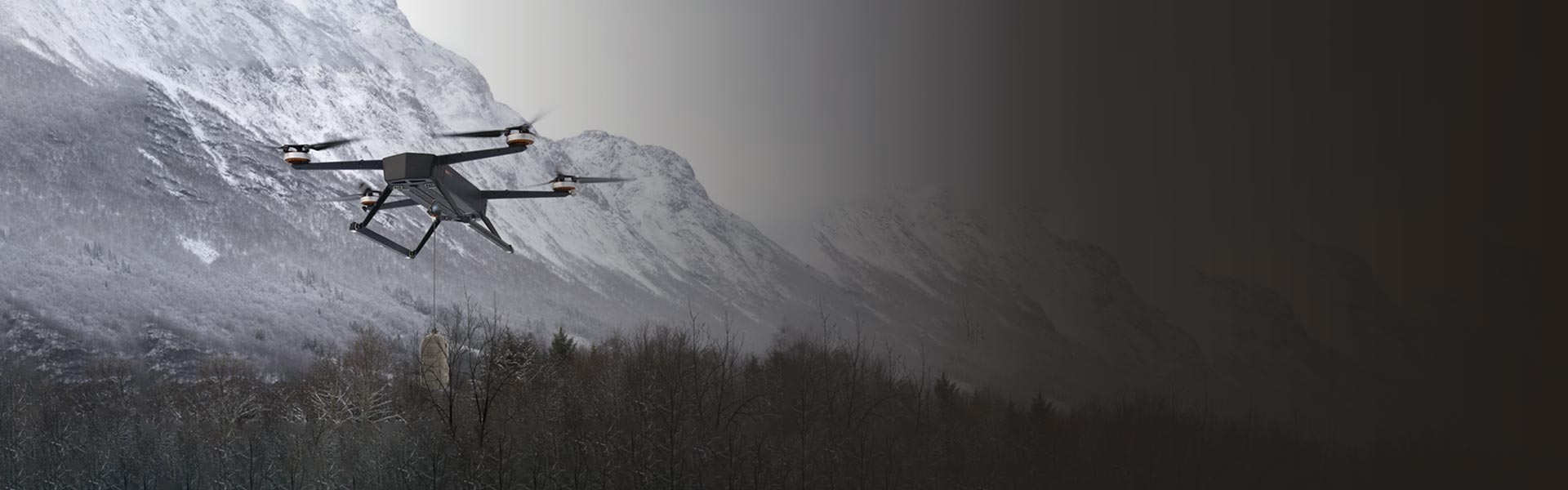
Mistral offers various types of Tactical Drones and Military Drones for emergency management and mission-critical operations. These rugged military drones are designed to meet the demanding needs of Border Security and Armed Forces and are optimal for a range of applications such as high-altitude logistics delivery, ISR, mine detection and neutralization, combat, and target decoys, among others. We offer customized tactical drones based on user-specific requirements, to meet the varying demands of weight, flight altitude, payload capability, endurance, arm and ammunition integration, electro-optical features and ruggedness.
The advanced AI technologies and visual algorithms in Mistral’s tactical drones and tactical military drones aid intelligent mapping of defined geographical areas; detect and classify objects of interest at low light and harsh weather conditions. These cutting-edge features make our tactical military drones ideal for cross-border surveillance and to gather crucial situational awareness during a conflict and gather intelligence on border activities. The rugged tactical drones are designed to transport in small SUVs and trucks and can be deployed in minutes from any terrain. These tactical military drones have a varying operational range of 3-10 km and can fly at an altitude of 5000 to 20,000 feet, based on the payload, Electro-optical sensor specifications.
Tactical Military Drones – Flight Modes
Tactical military drones are equipped with advanced technology that enables them to perform a variety of functions, including surveillance, reconnaissance, target acquisition, and even weapon delivery. Mistral offers Tactical military drones in a range of sizes and capabilities, from small quadcopters to large Hexacopters.
The tactical drones from Mistral come with three flight modes, Manual, fully Autonomous and pre-mapped Autonomous. The user can define the mode of flight based on operational needs in these rugged Military Drones. For instance, for periodic cross-border surveillance at a defined area, a fully autonomous mode would be ideal. However, during a conflict wherein every second is crucial, Manual or semi-autonomous operation would provide quick insights to the operator. In case of link loss (loss of connectivity with GCS) due to signal jamming or extreme weather conditions, the Auto Return Home feature aids the drones to return to the launch safely. Mistral also offers Tactical Military drones for distant surveillance with a range of up to 45kms, especially with stealth capabilities. These ultra-lite ultra-portable military drones are among the best tactical drones in the market.
Mistral’s rugged tactical drones come with ergonomically designed, user-friendly Ground Control Stations (GCS). The multi-layered safety protocols ensure secure communication between GCS and the drones. Based on the application and use case, the GCS can be designed to have single or dual displays to provide maximum usability and operational convenience to the operator on the field.
To know about Mistral Armed Drones, click here; Know more about Heavy Payload Drone click here.

EXPERTISE
Mistral possesses years of experience and expertise designing and developing versatile, swiftly deployable Tactical drones ideal for various law and order operations. Tactical drones, ranging from reconnaissance UAVs, heavy payload drones to combat drones, are engineered for strategic intelligence gathering and other defense applications. Our designs emphasize stealth, endurance, and advanced payload integration, allowing for covert missions and targeted operations.
Sensors
- Thermal, Telescopic Cameras
- Barrel Cameras
- 360 Bird’s Eye – Pilot Camera
- RADARs
- Laser Range Finders and Illuminators
- LiDAR Sensors & Scanners
- EO/IR Gimbals
Flight Modes
- Manual
- Semi-Autonomous
- Fully Autonomous
Operational Features
- Range of 3 to 10 km
- Altitude of 5000 to 20000 ft above MSL
- Payloads of 10 to 50KG
- 20 to 45 minutes of continuous operation
- Quick swap of Battery and Payload
- Day/night operational modes
- Multi-layered safety protocols
Ground Control Station
- User-friendly UI
- Provides live data from drones - Pilot camera, flight data, performance, mission data etc.
- Manage mission operation and flight modes
- Controls the launch, flight, and return of the drone
- Processes data from various drone sensors
Drone Variants
- Drones for ISTAR
- Heavy Payload Drones
- Armed Drones
- Mine Detection and Detonation Drones
- Stealth Drones
- AI-based Cross Border Surveillance
APPLICATIONS

Tactical Operations
Custom-designed drones that offer advanced features such as real-time HD video streaming, precise targeting, and intelligence gathering, enabling enhanced situational awareness and operational effectiveness during tactical operations like Rescue missions, VIP Security, Rallies, etc.
Cross Border Surveillance
Advanced nano-drones for cross-border surveillance feature high-altitude, long-range flight capabilities, advanced sensors with 3-axis gimbals, and real-time data transmission, aiding border forces in monitoring and gathering intelligence to enhance situational awarenes

Small Arms Conflicts
Advanced drones that offer aerial reconnaissance, target acquisition, and real-time situational updates to enhance tactical decision-making, minimize risks, and increase operational effectiveness for ground forces during small arm conflicts.

Landmine Detection
Tactical Drones equipped with specialized sensors and ground penetrating Radars that can efficiently detect and locate landmines, ensuring safety of personnel and facilitating effective clearance operations in mine-affected areas.

Disaster Management
Advanced Tactical Drones for disaster management that support aerial surveillance, rapid response, real-time mapping, and provide situational awareness, assisting the forces in damage assessment and search-and-rescue operations.
High-altitude Logistics Delivery
High-altitude logistics delivery drones for the Army and Border Security Forces aid in the quick and safe transportation of essential supplies, medical equipment, and emergency provisions to remote and inaccessible areas during critical missions.
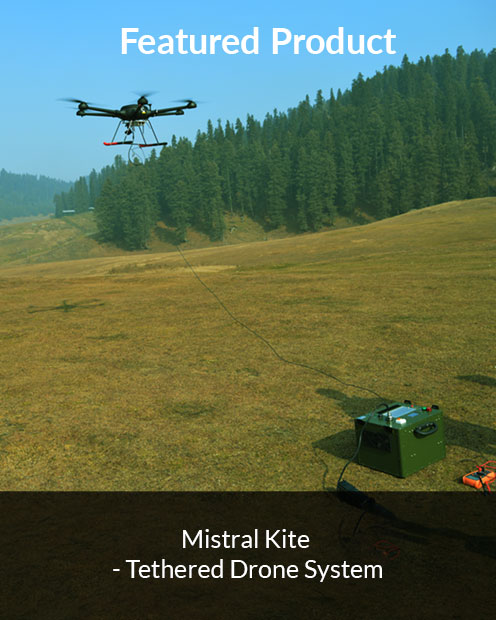
Featured Product